Home
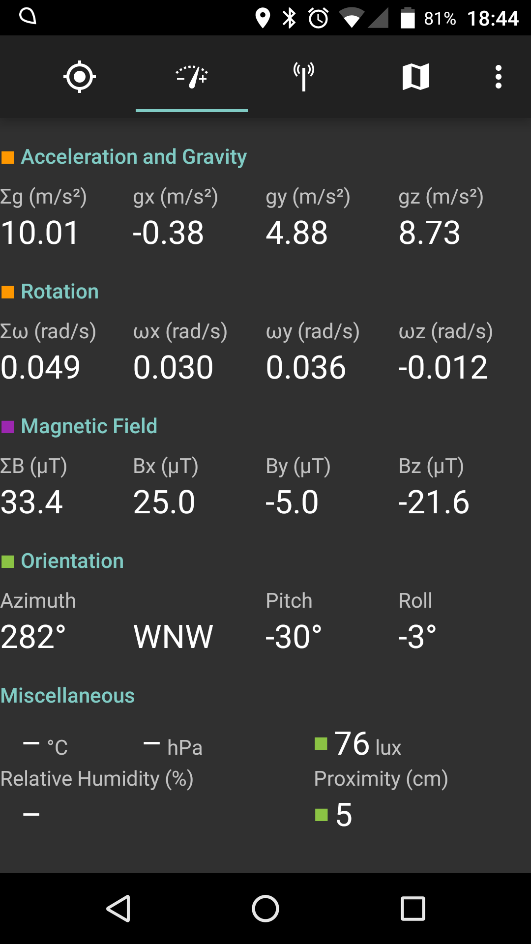
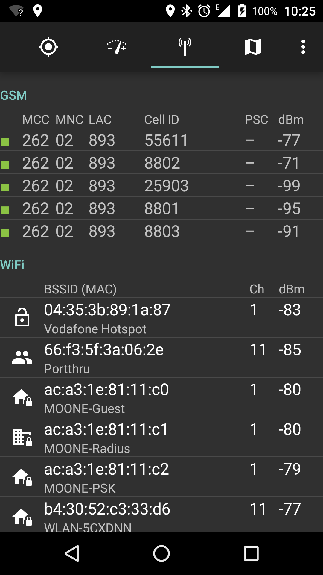
Displays GPS position and status, sensor data and networks (cellular and WiFi) in range

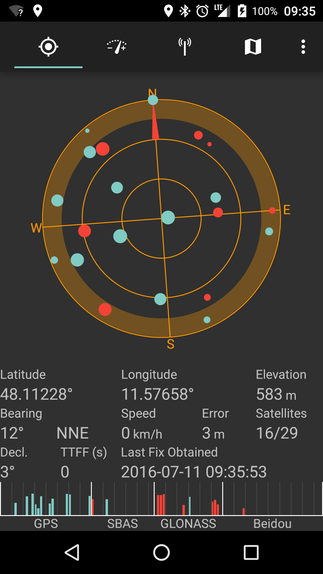
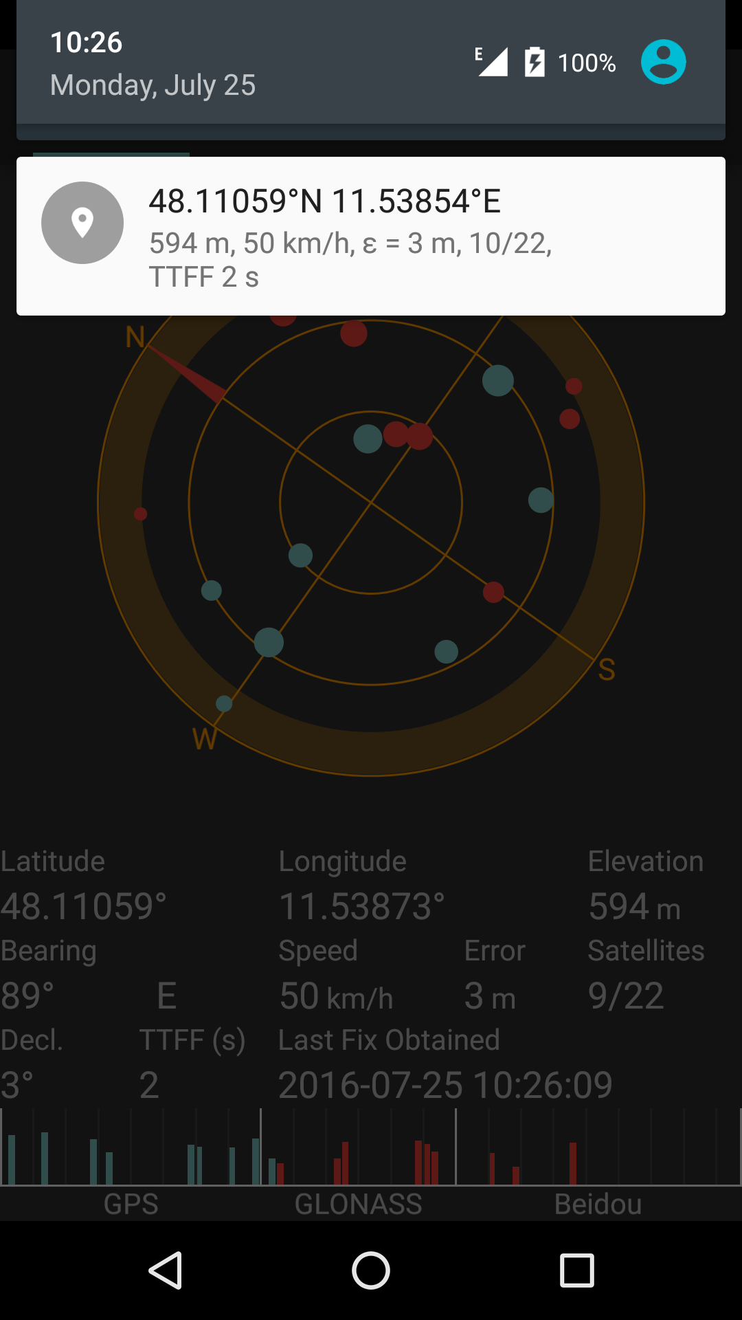
Taken from https://github.com/mvglasow/satstat/issues/53 :
In a nutshell, each color stands for a location provider.
Red is GPS, though nowadays most devices also support GLONASS and/or Beidou. Those hybrid chips report all of these systems as extra GPS satellites, thus you get multiple systems under one provider.
Blue is network. Again, Android has a single location provider for both wifi and cell location.
If additional location providers are present on the system (which I have never seen in practice but the Android API allows for it), they will be assigned random colors.
Gray markers are for stale locations, i.e. the last location we got from a provider which is currently not supplying any data. For example, if you enter a tunnel, the GPS marker will turn gray after a few seconds.
BTW, the circle denotes accuracy: smaller circles mean better accuracy. In other words: your actual location is somewhere within the circle.